|
|

|

|

|
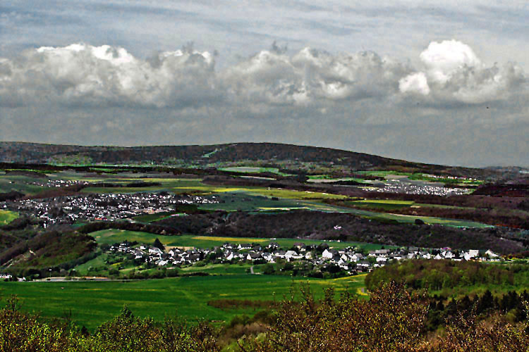
Lützelsoon with Devil's RockFive larger mountain ridges can be distinguished from each other in the Hunsrück: The Hochwald, to the West of the Erbeskopf (816m) is the highest German mountain West of the Rhine; the approximately 30km long quarzite ridge of the Idarwald forest with the Idarkopf (746m); the Lützelsoon with the Womrather Höhe (597m); the south-eastern Soonwald forest formed by three parallel mountain ridges, the highest point of which is the Ellerspring (657m); and the Binger forest with the Salzkopf (628m). Three hundred million years ago, at the end of the Carbon Age, the Devon layers of the Hunsrück were squeezed together by a massive pressure directed from southeast to northwest. The subsequent folding and creation of landmasses resulted in the Variscian mountain range (Northern range). Together with the current Hochwald forest-, Idarwald forest-, and Soonwald forest ranges a high altitude mountain range developed that eroded over millions of years. Very hard quarzite resisted the erosion in some places better than other stone types, and was therefore "dug" up. One of these quarzite pieces is the Teufelsfels (natural monument, translated: Devil's rock), which —like the "Berger Wacken"— lies on a wooded hilltop of the Lützelsoon (568m) like a massive boulder ("de dick Steen"). Photo: View from the observation tower on the Teufelsfels mountain (569m) over to the Idarkopf. In the foreground the villages of Schneppenbach and Bundenbach, and a little further back on the right Rhaunen. |
|
|
|
|
| [ Mail to Webmaster ] info@maasberg.ch |
|